Philip Baldaeus Maps
4
to
1
4
4
4
4
4
4
10
104
63
29
26
Creator: Philip Baldaeus
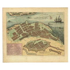
Very Attractive Handcolored Antique Plan of Cochin in India, 1744
By Philip Baldaeus
Located in Langweer, NL
Antique map titled 'The City of Cochin (..).' Plan of Cochin, Malabar Coast, India, during the attack by Admiral van Goens in 1663. This map was published in 'The True and Exact Desc...
Category
18th Century Antique Philip Baldaeus Maps
Materials
Paper
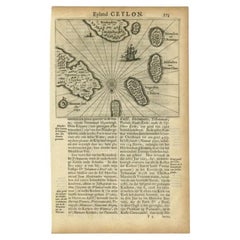
Antique Map of the Islands Near Ceylon by Baldaeus, 1672
By Philip Baldaeus
Located in Langweer, NL
Antique print, untitled. This original antique print shows the islands Leyden, Middelburg, Hammenhiel, Bramines, Dona Clara and Deserta near Ceylon / Sri Lanka, with their Dutch name...
Category
17th Century Antique Philip Baldaeus Maps
Materials
Paper
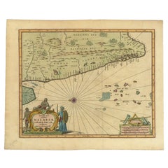
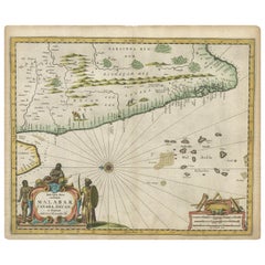
Antique Map of the Malabar Coast by Baldaeus, 1744
By Philip Baldaeus
Located in Langweer, NL
Antique map titled 'Descriptio Nova Imperii Malabar (..).' Nice map of the Malabar Coast. This map was published in 'The True and Exact Description of the Most Celebrated East - Indi...
Category
18th Century Antique Philip Baldaeus Maps
Materials
Paper
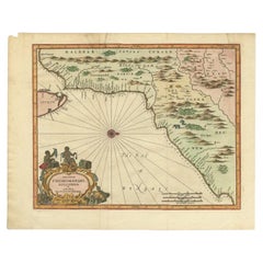
Antique Map of Choromandel, Golconda and Orixa, Malabar, India, 1744
By Philip Baldaeus
Located in Langweer, NL
Antique map titled 'Regionum Choromandel, Golconda (..).' Handsome map of Choromandel, Golconda and Orixa, published in 'The True and Exact Description of the Most Celebrated East - ...
Category
18th Century Antique Philip Baldaeus Maps
Materials
Paper
Related Items
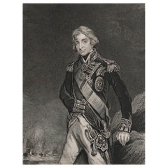
Original Antique Print, Portrait of Lord Nelson, circa 1850
Located in St Annes, Lancashire
Great image of Lord Nelson
Fine steel engraving by H.Robinson
After J.Hoppner
Published circa 1850
Unframed.
Category
1850s English Antique Philip Baldaeus Maps
Materials
Paper
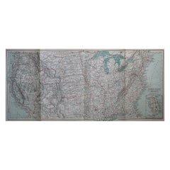
Original Antique Map of The United States of America, circa 1890
Located in St Annes, Lancashire
Great map of the USA
By The Stanford's Geographical Establishment
Original colour
Unframed.
Category
1890s English Victorian Antique Philip Baldaeus Maps
Materials
Paper
Original Antique Map of Asia. C.1780
Located in St Annes, Lancashire
Great map of Asia
Copper-plate engraving
Published C.1780
Two small worm holes to right side of map
Unframed.
Category
Early 1800s English Georgian Antique Philip Baldaeus Maps
Materials
Paper
Original Antique Map of India. C.1780
Located in St Annes, Lancashire
Great map of India
Copper-plate engraving
Published C.1780
Three small worm holes to right side of map and one bottom left corner
Unframed.
Category
Early 1800s English Georgian Antique Philip Baldaeus Maps
Materials
Paper
Original Antique Map of Italy. C.1780
Located in St Annes, Lancashire
Great map of Italy
Copper-plate engraving
Published C.1780
Unframed.
Category
Early 1800s English Georgian Antique Philip Baldaeus Maps
Materials
Paper
1868 Map of the Upper Part of the Island of Manhattan Above 86th Street
By Wm. Rogers Mfg. Co.
Located in San Francisco, CA
This wonderful piece of New York City history is over 150 years old. It depicts 86th street and above. It was lithographed by WC Rogers and company. It was made to show what was the Battle of Harlem during the Revolutionary war...
Category
1860s American American Colonial Antique Philip Baldaeus Maps
Materials
Paper
Large Original Vintage Map of The Pacific Islands Including Hawaii
Located in St Annes, Lancashire
Great map of The Pacific Islands
Unframed
Original color
By John Bartholomew and Co. Edinburgh Geographical Institute
Published, circa 1...
Category
1920s British Vintage Philip Baldaeus Maps
Materials
Paper
No Reserve
H 18 in W 23 in D 0.07 in
Original Antique Map of Ancient Greece, Achaia, Corinth, 1786
Located in St Annes, Lancashire
Great map of Ancient Greece. Showing the region of Thessaly, including Mount Olympus
Drawn by J.D. Barbie Du Bocage
Copper plate engraving by P.F Tardieu
Original hand color...
Category
1780s French Other Antique Philip Baldaeus Maps
Materials
Paper
1856 U.S. Coast Survey Map of Chesapeake Bay and Delaware Bay
Located in Colorado Springs, CO
Presented is U.S. Coast Survey nautical chart or maritime map of Chesapeake Bay and Delaware Bay from 1856. The map depicts the region from Susquehanna, Maryland to the northern Outer Banks in North Carolina. It also shows from Richmond and Petersburg, Virginia to the Atlantic Ocean. The map is highly detailed with many cities and towns labeled throughout. Rivers, inlets, and bays are also labeled. Various charts illustrating more specific parts of the region are marked on the map using dotted lines. The lines form boxes, and the corresponding chart number and publication date are given. Extensive triangulation surveys were conducted the length of Chesapeake Bay and are illustrated here. Hampton Roads, Virginia is labeled, along with the James, York, and Rappahannock Rivers, which were all extensively surveyed.
The chart was published under the supervision of A. D. Bache, one of the most influential and prolific figures in the early history of the U.S. Coast Survey, for the 1856 Report of the Superintendent of the U.S. Coast Survey. Alexander Dallas Bache (1806-1867) was an American physicist, scientist, and surveyor. Bache served as the Superintendent of the U.S. Coast Survey from 1843 to 1865. Born in Philadelphia, Bache toured Europe and composed an important treatise on European Education. He also served as president of Philadelphia's Central High School and was a professor of natural history and chemistry at the University of Pennsylvania. Upon the death of Ferdinand Rudolph Hassler, Bache was appointed Superintendent of the United States Coast Survey.
The Office of the Coast Survey, founded in 1807 by President Thomas Jefferson and Secretary of Commerce Albert Gallatin...
Category
1850s American Antique Philip Baldaeus Maps
Materials
Paper
Original Antique Map of Spain and Portugal, circa 1790
Located in St Annes, Lancashire
Super map of Spain and Portugal
Copper plate engraving by A. Bell
Published, circa 1790.
Unframed.
Category
1790s English Other Antique Philip Baldaeus Maps
Materials
Paper
"San Francisco, Upper California” 1851 Antique Map of San Francisco
Located in Colorado Springs, CO
This is a pictorial lettersheet view of the city and harbor of San Francisco. This lithograph was printed on grey wove paper, across a double sheet, by famed lithographers Britton & ...
Category
1850s American Antique Philip Baldaeus Maps
Materials
Paper
Original Antique Map of Spain and Portugal, Engraved By Barlow, 1806
Located in St Annes, Lancashire
Great map of Spain And Portugal
Copper-plate engraving by Barlow
Published by Brightly & Kinnersly, Bungay, Suffolk. 1806
Unframed.
Category
Early 1800s English Antique Philip Baldaeus Maps
Materials
Paper
No Reserve
H 8 in W 10 in D 0.07 in
Previously Available Items
Antique Map of Southern India by Baldaeus, circa 1672
By Philip Baldaeus
Located in Langweer, NL
Antique map titled 'Descriptio Nova Imperii Malabar, Canara, Decan; et Aliarum Provinciarum'. This beautiful map is considered one of the foremost sources regarding Dutch settlements...
Category
Late 17th Century Antique Philip Baldaeus Maps
Philip Baldaeus maps for sale on 1stDibs.
Philip Baldaeus maps are available for sale on 1stDibs. These distinctive items are frequently made of paper and are designed with extraordinary care. There are many options to choose from in our collection of Philip Baldaeus maps, although beige editions of this piece are particularly popular. If you’re looking for additional options, many customers also consider maps by Covens & Mortier, Abraham Ortelius, and Pieter Van Der Aa. Prices for Philip Baldaeus maps can differ depending upon size, time period and other attributes — on 1stDibs, these items begin at $135 and can go as high as $932, while a piece like these, on average, fetch $567.
